
Blog # 18 (Part 1)
By Kevin V. Hunt
Markers, monuments … and the dash! That is the life goal of every family historian (like me).
Over the years, we have received bulletins or newsletters from various family organizations established to help us remember our pioneer ancestral lines. Just this summer we received one from the “Parker Press”. My wife’s lineage includes Parker ancestors starting back many generations in her direct line. In this issue, I found a great quote for the moment: “… each marker represents a person, once living, a breathing person with a story or stories to share.”
With the passage of time and lives, various markers – headstones and other markers – are placed along the trail to mark the spot wherein lies the final earthly remains of a once breathing person. Often these stones show a carved inscription such as 1811 – 1852. That is what the marker for my 3rd Great Grandfather, Nathan Calhoun Cheney (located in Centerville, Utah) would have read – if it even had the dash.

I have found just a few hints about the dash of Nathan Cheney – and I will share those in a future blog post. (Admittedly, Nathan Calhoun Cheney is one of my ancestor heroes. I sure look forward to meeting him. I have always thought that his “dash” was way too short!)
Sadly, that is what most stones have – just a beginning date, an ending date, and the dash in between. What I want to know about is the “dash” for each ancestor. In that dash, there is likely much of joy, trails with pain and suffering, greatness, of adventure, of a whole lot of life … and always a story. Everyone has a story! Some are waiting to be discovered. Sometimes a story can be found in personal and family histories– and at other times, the dash is left totally to the imagination of those of us who have followed behind.
As a “dash hunter” for nearly sixty years, I am constantly looking for even the slightest hints of ways to expand that dash for as many ancestors as possible – and to share it/them with my family. Those dash stories are so interesting and wonderful. We should all find and then celebrate the “dash” of everyone in our family tree – both roots and branches.
GRAVE HUNTING WITH THE FAMILY
According to two daughters – reminiscing with “wo is me” in a single week – I guess I abused my children as they grew up. I dragged them incessantly to cemeteries all over Utah. I guess they had a traumatic childhood – thanks to me. Admittedly, we went to a few cemeteries … but I didn’t think that I went to enough to traumatize the children – so that they never want to again go to a cemetery.
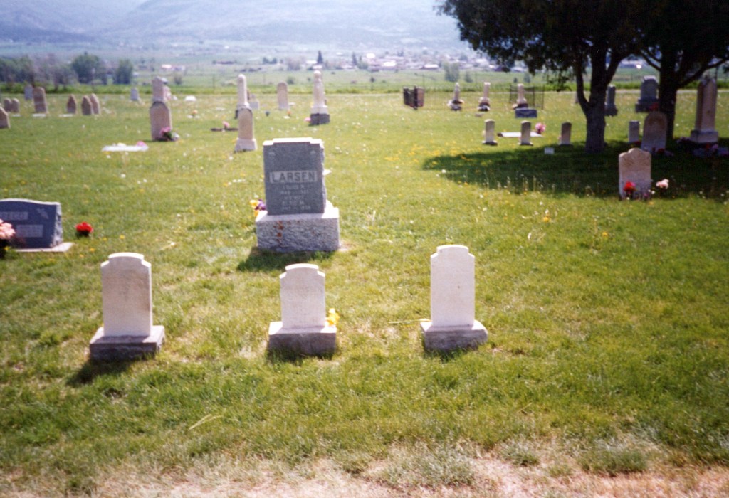
Mom’s Larsen Family in the Fairview, Utah Cemetery
Most of the cemeteries were kind of on the beaten path so they weren’t too challenging to find. The challenge came because we would not know where in the cemetery our people were buried. Upon arrival at a new cemetery, I would send my forces (all nine children) off to all points within the cemetery looking for the desired headstone(s). (It was a great activity when children needed a break from the van.)
One site was particularly bad and was so bad, I guess, that the authorities could probably come after me for what I did to all of the children on that occasion. No doubt, it may have permanently warped the children. We found ourselves in the middle of nowhere in central Utah (literally) in the remote village of Teasdale. I had never been to this place in my life – and the likelihood of getting back there again was pretty slim. I knew that this one was a once-in-a-lifetime opportunity to find my 3rd Great Grandfather, Amos Hunt. Most of my Hunts (from 1850 to my grandparents – were buried in Enterprise, Utah). Amos lived in southern Utah (around Enterprise) most of his life, but for his last couple of years, he lived with his daughter in Teasdale. And he died there.
Okay, so it may not have been the greatest of circumstances. It was winter, snowy and it was bitter cold. And most of the headstones were kind of hidden under the white stuff. Nonetheless, I sent out the troops. They were obedient, but they didn’t go happily. Gratefully, one of the soldiers did finally find the desired stone.

This experience was before the modern internet convenience. As I was writing this blog article, I decided to do a Google search for “Amos Hunt gravestone in Teasdale, Utah”. It worked! Within seconds, it was as if I was right there in the Teasdale, Utah and easily found the stone but minus the white stuff. I totally missed out on the adventure of finding the stone and the ambiance was just not the same!
MORE THAN JUST HISTORICAL SITES
I remember seeing signs for historic markers everywhere on our travels with the family through the years, but unless they coincided with a “drink and drain” function, we usually did not stop. Looking back now, I think that we may have missed out a bit. There are a lot of historic things out there that would have warranted a quick stop.
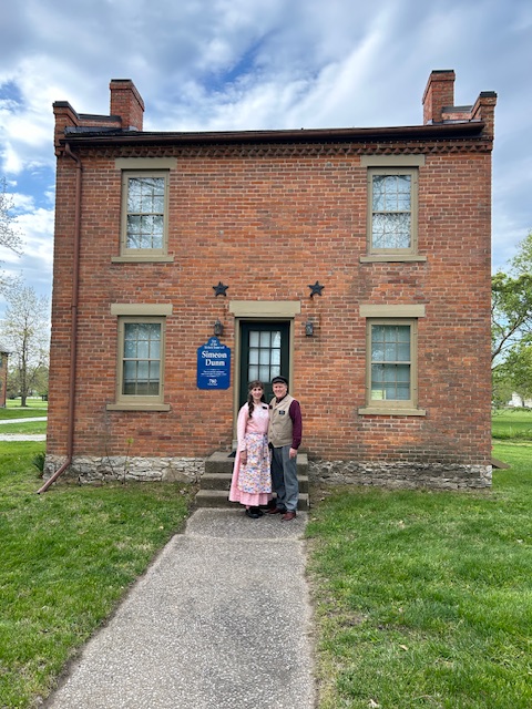
So, we, of course, are here in Nauvoo – a very historic place. Everything around us is historic in some way. Sister Hunt and I were called as “historic site guides”, and this means that we spend all of our days guiding folks and interpreting the history that is all around us. But, even we, with all of that around us, could miss much of that which is lurking hidden everywhere. I realized that we just need to open our eyes and expand our vision a bit.
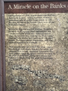
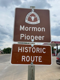
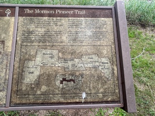
A TOUR OF IOWA AND ILLINOIS MARKERS AND SITES
It was to be our p-day, and we didn’t have much going on. One can only look at the walls around us so much. I always ask Sister Hunt what she would like to do – and being a “home body”, her answer is always the same. “I can’t think of anything.” She never has a long list of things to do nor places to go. But gratefully, she is always willing to go along with any on most adventure I might think up. This one particular Saturday (then on a p-day) seemed the perfect day to go out and about. Sister Hunt went along for the ride – afraid that the boogie man might get me if out by myself in the boondocks, etc. Women have a great imagination for such things! I was happy to have her along for the ride. She makes good company (and I am glad that we are missionary companions.)
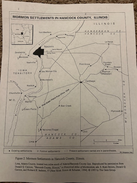
Quincy is in Adams County – south of Lima
I decided that we would take a history tour seeking anything and everything within a fifty-mile radius out from us. In preparation for the trip, I researched the internet the night before, for any “Mormon Pioneer” era markers that might be nearby. And so it was, on our p-day, that we headed out on a wandering adventure for the day. Before leaving, however, I doused my pant legs (at the ankles) and my shoes with some chigger deterrent spray. This is a must in our country. Chiggers are a microscopic, little “cootie” that creeps onto you unawares and then grabs you in the crotch or anywhere else around the belt, or on the legs. And we sure don’t want to get cooties! (Chiggers … not on the list of favorite creatures.)
We drove east from Nauvoo, and then north, and west across the Ft. Madison bridge (on the Mississippi River) and crossed into Iowa. Ft. Madison is a rather historic site – in and of itself – but we were specifically seeking sites peculiar to pioneers of The Church of Jesus Christ of Latter-day Saints (then known as “The Mormons”) (1840-1850). [There is that “dash” again].
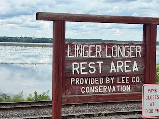
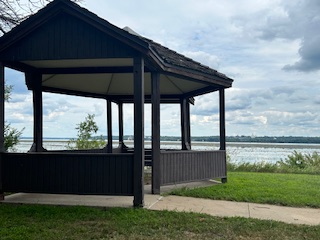
We drove south from Ft. Madison toward the town of Keokuk, Iowa. We first went to the “Linger Longer Park”. (What kind of name is that? Sounded like a Young Single Adult Sunday excuse to eat a little earlier on a fast Sunday.) Well, that was the name. With a bit of imagination, Google was somehow able to get us to the remote spot on the banks of the Mississippi River – and just north of present-day Montrose (formerly part of Zarahemla!)
We found ourselves in a quiet little spot across the river from Nauvoo. (And we could see the majestic spires of our Temple on the hill.)
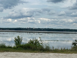
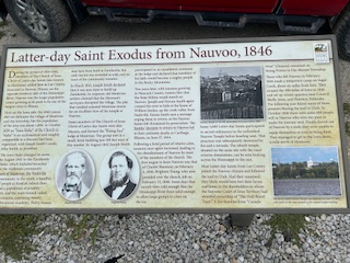
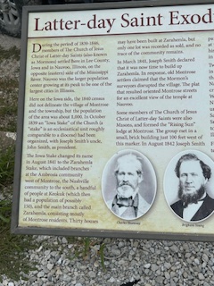
THE MIRACLE OF THE QUAIL
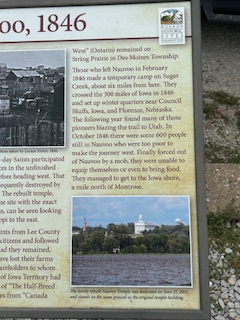
It was October 9, 1846. Most of the Saints had already left Nauvoo and had headed out across Iowa. The ones who were left were the poorest of the poor – who had no means to make the journey. They were ill-equipped and quite unprepared. They had been forced out of Nauvoo during the “War of Nauvoo” a few days before. The Saints were impoverished and destitute as they “camped” on the riverbank just over the river.
On that occasion, several flocks of quail flew into their camp and provided them with sufficient food – enough to feed about 640 people. Eye-witness participants said that quail were everywhere, and the Saints could just go and scoop them up – to be prepared and made into a tasty meal.
The miracle is reminiscent of the miracle that the Lord performed for ancient Israel during their exodus our of Egypt under the leadership of Moses. This was truly a miracle for the Saints.
This site is also the first stop for the frozen emigrating Saints as they made it across the frozen Mississippi River – as they were pressed prematurely out of Nauvoo. They spent some miserable nights in the bitter cold there along the frozen river – with wagons pointed west and headed for Salt Lake City – far out in the unknown west. Many folks were not equipped for that horrible scene that befell them.
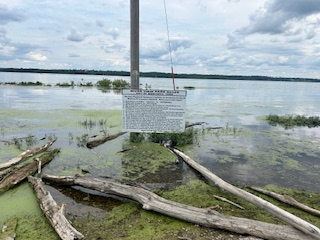
In light of the above, Montrose obviously became the start of the Mormon migration west. Now the historic Lee County site hosts a marker stating such by the Iowa Mormon Trails Association.

We did find the markers – but they were not quite as depicted on Google. Time had taken its toll on the once beautiful markers.
It was noted at the plaque placement ceremonies that more improvements were planned for the next couple of years – including paving the parking lot and adding shelters to the picnic tables. (I must have missed those!)
RIVERVIEW PARK IN MONTROSE, IOWA
Just a mile or two south – still at the river’s edge, we found the Riverview Park. If this park was impressive at some point, it had outlived that designation. The smell of dead fish along the riverbank seemed to mask the beauty of what might have been.
Montrose, Iowa is historic for a few reasons. One is that prior to or concurrent to the settlement of Nauvoo, many of the Saints – recently extracted from Missouri, had ventured north seeking a peaceful new gathering place. (Joseph Smith was still in the Liberty Jail.) Many the exiled Saints found meager refuge in what was already an “abandoned” military base (old Ft. Des Moines). And if the place had been long abandoned before, imagine what time did to them. They could not have been too marvelous.
One can only imagine how bad these facilities might have been. Of course, this was long before the advent of modern plumbing – for toilet functions – or for getting water.
The weather then was bitter cold. But, nonetheless, the Saints were brave enough to huddle into what had to be very squashed and most uncomfortable quarters. Wilford Woodruff stated that he and his family moved into one “barracks” room that they shared with the Brigham Young family. (Quite the scene for two future prophets holed up in such scant circumstances together.)
On June 20, 1839, the “Mormon” Church (more specifically The Church of Jesus Christ of Latter-day Saints) bought 20,000 acres of land around Montrose from Isaac Galland for $2 an acre. In 1841, 750 Mormons lived in the newly created Iowa stake. In Montrose, the Prophet Joseph Smith was in Montrose and made the statement that the Mormons would be driven to the Rocky Mountains and would become a powerful people.” (Source: Ensignpeakfoundation.org/Montrose-iowa-monuments-2003)
This site, along with three other historic Mormon Pioneer sites were originally dedicated all on one day in 2003 with appropriate fanfare and a small entourage of local dignitaries. In those days, the dedication trek began at Keokuk and moved northward to the Linger Longer scene noted above. Doug Atterberg was the local historian most responsible for the joyous occasions. The plaques were created in concert by the Mormon Trails Organization and the local Lee County Conservation Board and supported by local leaders. A double quartet must have been impressive when they sang, “Come, Come, Ye Saints” – the famous Mormon Pioneer anthem that was written on the Mormon Trail in Wayne County – located in south central Iowa.

Over 20 years have passed since the placement of the various plaques and the passage of time has not been good for them. Today they are faded and difficult (at best) to read their messages. It was a grand idea at the time and one which should be one for rejoicing – for at least history was acknowledged at that one moment.
Google states that there were two different markers placed in Riverview Park back then in 2003. I had a hard time finding both markers. I did find evidence of what might have been two markers located within one 16’ square cement border. Again, time was not on the side of the original plaques.
TRIANGLE PARK IN KEOKUK
We continued our trek, and our next stop was at Triangle Park in the town of Keokuk, Iowa. (Typically, we get to Keokuk via the beautiful river road south from Nauvoo. This time, however, we went south on the Iowa side of the river.)
At the original plaque dedication held in 2003, Rob Clark, a member of the Mormon Historic Sites Foundation board of trustees, said, “… the story here is one of friendship, openness, and good will. We hope when the latter-day Saints visit here, they do so in a spirit of friendship. We hope this marker is a symbol of friendship.” (Source: Ensignpeakfoundation.org/Montrose-iowa-monuments-2003)

It was interesting in our quest to find the Keokuk plaque. This miniscule “Triangle Park” was hidden away at the peak of a very small park in a secluded residential area. I wondered with its placement if anyone might ever even happen by to see the plaque. This plaque was in somewhat better shape than the previous plaques, but it was still weathered and worn.

I did not know this before, but I learned that many emigrating Saints made a stop in Keokuk as they progressed upriver from St. Louis (and beyond). Keokuk actually became a staging center for the Saints as they outfitted for their westward trek.
The record states: “On 1 April 1853, a steamboat docked at Keokuk and discharged some 200 passengers, the first of 2,500 Mormon immigrants who were to camp at Keokuk that spring, to earn money and to learn survival skills before taking the trail to Utah. … Eight shiploads of Mormon immigrants sailed from Liverpool to New Orleans between January and May 1853. Steamboats transported them to St Louis, where most paused before taking another boat to Keokuk. Three steamboats of the St. Louis and Keokuk Packet Company made twice-weekly scheduled runs. The first ship leaving Liverpool carried mostly Danes, but their ocean crossing took so long, a Mormon company of English folk were the first to arrive at Keokuk. …Among the immigrants was artist Frederick Piercy, who sketched scenes along the immigrants’ route, including “Camp at Keokuk,” (https://www.hmdb.org/m.asp?m=179356)

One migrant noted, “Elder Isaac C. Haight, who was the Church Emigration agent at the outfitting point, selected a very healthy camping place at Keokuk, on a bluff near the river, where there was plenty of wood and grass handy. The citizens of Keokuk manifested a benevolent feeling toward the Saints, which was highly appreciated by them … The Mormons are mainly honest, earnest and sincere.” (Source: Ensignpeakfoundation.org/Montrose-iowa-monuments-2003)
In May 1853 William Belknap, who later served as a major general in the Civil War and as Secretary of War to President Grant, wrote the following to his sister, Clara, about the Mormon emigrants who were outfitting in Keokuk that spring and summer. “Yesterday was Sunday and I wish you had been here to go up to the Mormon camp with me. They had preaching at three stands in three languages – English, German and Danish. They sing – especially the Danes – very sincerely and are perfectly enthusiastic. It is a strange, strange mystery and if you were here, you’d be astonished. There are nearly 3,500 here now and “still they come” by boat and some of them are genteel and many of the girls [are] very pretty…. The Mormons are mainly honest, earnest and sincere.” (Source: Ensignpeakfoundation.org/Montrose-iowa-monuments-2003)
The Keokuk plaque was placed by the Mormon Historic Sites Foundation. It was interesting that the modern Foundation helped place curb and gutter around the small park – just as the pioneers before them helped grade part of the area where they disembarked.
We normally do our shopping in Keokuk, but we delayed our shopping (and our traditional “Pecan Mudslide” at Dairy Queen) until a pass-through on our return trip home. We continued south toward the town of Quincy. There were other stops that I wanted to make along the way. We crossed the river and went back into Illinois before we headed south on Highway 96 toward Quincy.
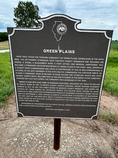
THE MORLEY SETTLEMENT
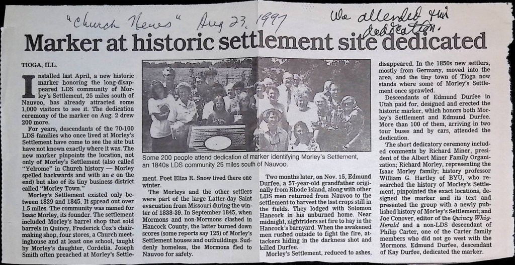
I knew that a plaque had been placed in the very rural village of present-day Tioga, Illinois – because I was there when it was placed back in 1997.
Finding the plaque back then was a bit easier than today. I had specific directions back then and easily found the location for the plaque ceremony. Today, it was a bit more challenging. We found the village of Tioga and drove around a while seeking the plaque. We finally stopped to ask a friendly and helpful local resident and business owner for directions. He told us exactly where to go.
I remembered the spot being somewhat secluded, but I did not remember that it was totally surrounded by the Illinois corn and soybean fields. I thought I remembered a few houses and a nearby country church. These were not readily evident. (Actually, the beautiful country church was there – but it was a couple of blocks away.

Talk about being in the “middle of nowhere …” This was the spot. It was difficult to even see the plaque amongst the fields and growth of weeds surrounding it. Then it was there. I had found its hiding place. And I was glad that I had my anti-chigger spray on for this moment – even though it was only through about 12 feet of very high prairie grass.
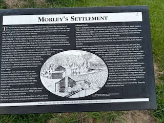
The rural community was known back then as the “Morley’s Settlement” because many of the settlers included converts and missionaries who brought the Gospel to them. The Hancock family (including father Thomas and sons, Levi Ward and Solomon – and my own 4th great grandmother, Clarissa Hancock Alger) had been together in Ohio and later in Missouri. Also in the group was the Simeon Carter family. This family are ancestors to my wife. After the Saints were expelled from Missouri, this same group of Saints settled in this rural area of Illinois.
PLACEMENT OF THE 1997 PLAQUE
I said that I was there … On that summer day, August 2, 1997, Lou (Sister Hunt) and I had come from our Mesa, Arizona home to participate in the historic pageant, “City of Joseph” in Nauvoo. As we attended Church in the local Nauvoo ward the Sunday before, we learned of a plaque dedication ceremony to be held on Saturday to commemorate the Hancock, Durfee, Morley and other families who lived in Yelrome.
On that date, I recorded in my journal: “We had cast call at the early hour of 8:30 AM this morning. We first had a clean-up of the whole area – that was a mess following last night’s show. We then gathered for “cast notes”.
“We (the Hunt family) left the set at 10:00 AM as they were ready to start a cast dance. … We then went back to the campground. Marinda, Keith, and I changed into our pageant costumes. We drove south on Highway #96 toward Quincy. We went to a little town now called Tioga. This is about 26 miles south of Nauvoo. We followed some cars ahead of us. We parked and walked about two blocks down to a plaque which was to be dedicated today. The plaque is in memory of the pioneers who lived at the Morley Settlement (also known as “Yelrome” which is “Morley” backwards).
“At the Morley Settlement the mobs came and burned down everything which the Mormons had. (Settler, Edmund Durfee died in this incident.) This occurred in September of 1845.
[Historical Note: On Wednesday the 10th of September an anti-Mormon mob of arsonists burned down the Durfee home, and shortly thereafter, burned down the homes of dozens of other Mormon families. On the morning of the 11th, they again set fire to more of the homes.
After losing their homes, the Durfees, Hancocks, and other homeless residents fled to Nauvoo for safety. Edmund and other residents returned to Yelrome on November 15, 1845, to harvest crops and stayed in the unburned Solomon Hancock home. Late that evening, night riders set fire to hay in the Hancock barnyard. Awakened, the Latter-day Saint men rushed outside to fight the fire. Edmund Durfee, who was age 57 at the time, was shot in the back and killed.
My journal continues:
“… About 150 people gathered to the site of the plaque. The group included two bus loads of the Durfee family who had come en masses from Salt Lake to St. Louis and then to Tioga. The rest of us heard of the ceremonies in various ways.
Keith and Marinda under shade of the plaque
“The festivities were planned mostly by the Durfee family as a memorial to their slain ancestor. so, the plaque was mostly on him – though the other families were mentioned. A Durfee conducted the meeting/program. As he spoke, he asked about the gathered group. Our family was the only one there from the Hancock descendants. The man had me (with others) say who we were.

“As I mentioned Hancock he said, “Hallelujah for the Hancock family.” I learned today that Solomon Hancock, brother to our Clarissa – and son of Thomas Hancock, was the man who baptized Edmund Durfee.
“I met a man named Paul Hansen from San Diego. He shook my hand and said, “I’m indebted to you because your ancestry baptized mine.”
“During the program we heard more from the Durfee, Carter and Morley families. The speakers spoke of the history of the settlement and the lives of some of the people. A couple of ladies sang two musical numbers.

“I was glad that the three of us wore our costumes. This added to the scene.
“It was interesting that the Durfees had arranged with the local Church of Christ congregation to host them for lunch. This was probably a good missionary activity.
“Our kids (most of them) wondered why we went to this dedication. They acted bored and wanted to be on our way (afraid they’d miss lunch at the campground). I was very glad that we were there – especially since there was no one else there for the Hancock family. I think that we will all see the day in which we’ll rejoice that we were a part of this program. Family from the other side of the veil are also probably pleased that we were there.”
UNEXPECTED HISTORIC MARKERS ALONG THE WAY
As we continued our journey to Quincy, we noted an unexpected “Historic Marker” sign along the way. I did a quick U-turn back to see the sign. It was interesting that it was a marker in favor of the mob that killed the prophet, Joseph, and Hyrum, at Carthage. I guess history commemorates the bad as well as the good people. It did commemorate a Mormon family in a good way.
We saw another beautiful monument as we whizzed by. I could not resist a turn-back to check it out.
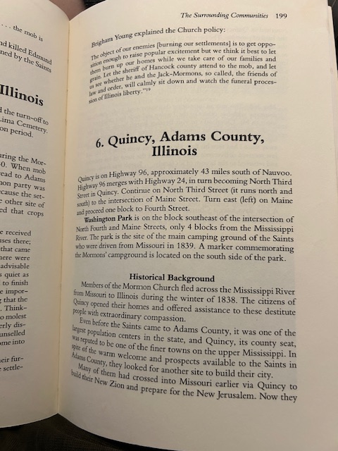
WASHINGTON PARK IN QUINCY
Sister Hunt got detoured when she saw a Goodwill store in Quincy. So, while she remained to drool over their merchandise (her greatest thrill), I followed directions of a store worker and went about three blocks south to the Washington Park. It was in this area that the Saints – exiled from the violent mobs in Missouri – had camped. The wonderful people of Quincy welcomed the Saints and did all that they could do to assist them with shelter, food and more.
I made a pass through the park seeking the plaque that I knew had to be there somewhere. I came to three homeless guy types, and I asked them if they might know where the plaque might be. They pointed me to the opposite side of the park. I finally found the plaque that I sought. This plaque too, was very vintage and showed that it had been in the park for many years – but it was actually in better shape than some of the other markers I had seen.
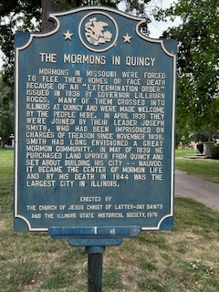
On 5 July 2002 (following the dedication of the restored Nauvoo Temple with the Mormon Tabernacle Choir) – a church website https://newsroom.churchofjesuschrist.org/article/quincy reported a news story.
“QUINCY, Ill. — The Mormon Tabernacle Choir gave a rare benefit concert here tonight to say thank you for kindness extended 163 years ago by the citizens of Quincy to Latter-day Saints fleeing religious persecution during the winter of 1839. $75,000 in concert proceeds will benefit the Quincy Area Community Foundation.
President Gordon B. Hinckley, world leader of The Church of Jesus Christ of Latter-day Saints, personally announced to the concert audience those proceeds had been conveyed to Mayor Charles W. Scholz.
“We shall always be grateful for the kindness, the hospitality, the civility with which your people met our people who were exiles from the state of Missouri,” President Hinckley said. “I express my gratitude to those who are successors of those who were here long ago and say thank you with all of our hearts.”
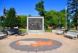
OTHER SURPRISE PLAQUES IN WASHINGTON PARK
I was surprised to find another set of plaques and statues in this Washington Park. I guess it was at this same Washington Park that the famous and very historic 6th Lincoln/Douglas debate was held in Quincy on October 13, 1858. I enjoyed the interesting information displayed about the debate.
OUR RETURN TO KEOKUK
While in Quincy, we found another Goodwill store – this one much bigger and newer than the previous one. Here Lou was delighted to find the bread making machine she had been searching for – along with an ice cream maker and waffle iron – all at great … and Sister Hunt was elated as she “had attracted this to her” (and God put it in her path). There goes my mannish figure!
While in Quincy, we also ate at the local Texas Roadhouse restaurant. They do not have such places anywhere closer to us. Quincy is located about 50 miles south of Nauvoo. This is about like us driving from Maricopa to Mesa – a trip which we made frequently in Arizona – but this trip from Nauvoo to Quincy seems further.
It was now past sunset, and we began our trip backwards to Keokuk. We did our usual business there (including the D.Q.) and returned to our Nauvoo home.
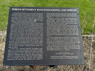
OUR FAMILY FOOTPRINTS IN RAMUS – NOW KNOWN AS THE TOWN OF WEBSTER
I was doing other historical research and read that Benjamin H. Johnson had lived in Ramus. When I had done the Google search for Mormon monuments within 50 miles of Nauvoo the town of Webster came up in that search. And as I read of Ramus, I recognized the name of Benjamin and remembered that he was the ancestor of our son-in-law – Michael – husband of our Jackie.) Also in the research, I learned that Ute Perkins – the ancestor of my wife – had also lived there. Interesting that the two family lines connected there.
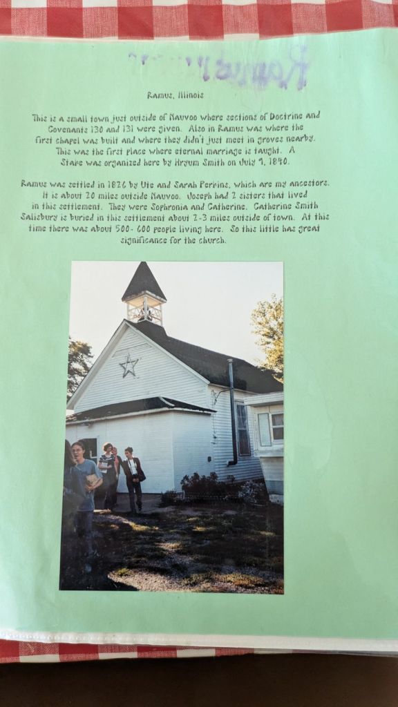
I learned in the research that the Prophet, Joseph, visited in the home (more than once) in the Benjamin Johnson home. And on one of those occasions, Joseph took the hands of Benjamin and his wife and there in their own living room, sealed them together as eternal companions.
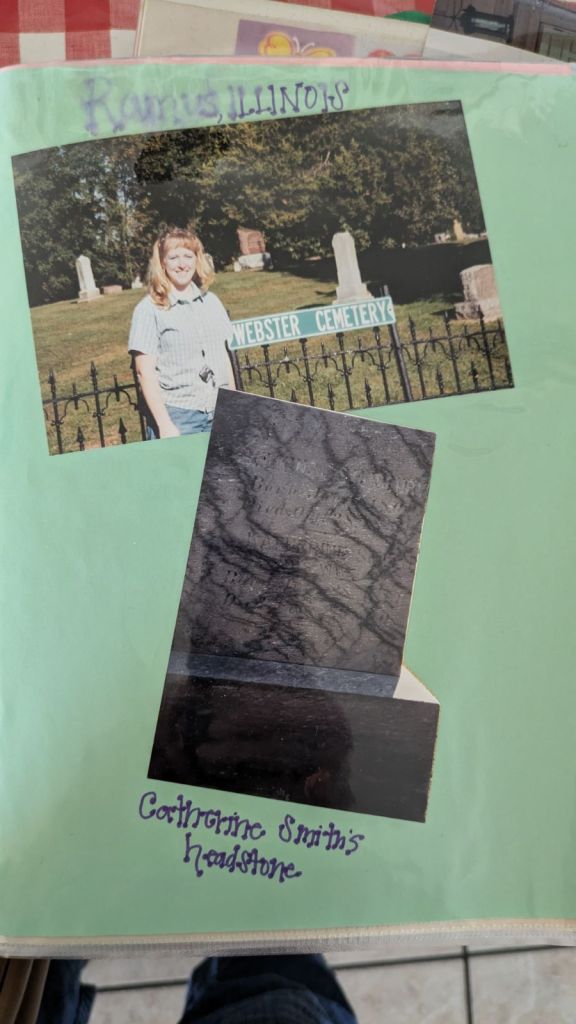
Joseph Smith’s sister, Catherine is buried in Ramus/Webster:
With the childhood abuse that I inflicted on the children (relative to cemetery tromping), Jackie was probably not jazzed when they visited, and I suggested that we make a family trek to Ramus. We did, and she will likely never forgive me. I hadn’t known of her cemeteraphobia when I suggested the trip.
Anyway, it was a Sunday afternoon and Sister Hunt, and I had a rather rare “not scheduled” assignment. Nice! We used the time to go to Carthage and then went east to Ramus (now Webster) to check out the place.
Webster is one of those places that was probably a lot better in its former time. The current scene is not overly impressive – but it is historical and thus very interesting.
On-line, I had seen a very old church, and we somehow found our way there. We found a very dilapidated and run-down country church.
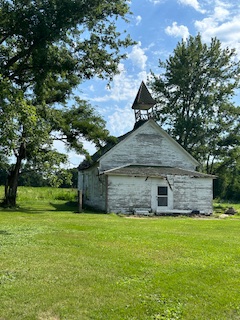
We found a very unique plaque on-site that noted that there had been a former church on the site – and that wood from that original chapel was used to construct the more modern facility.
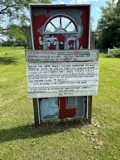
(And interesting that this “new church” was also now hardly standing and obviously very old and fragile. The sign noted that the foundation and cornerstones of the old Mormon church was still evident – and we saw the four cornerstones of the former building.

It is interesting that this original chapel was noted as the “first LDS chapel built in the state of Illinois”.
Unplanned “Selfie” at the Ramus Church Sign
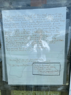
The sign had the phone number of a local guy who now owns the church property. I texted this guy and he wrote me back. He said that his mother was at that moment dying and he promised to get back with me “after the funeral”. He said that he is the current owner of the former Benjamin Johnson property – and noted that it too, is for sale. Wow! I will have to check back with this guy after things have mellowed out a bit for him.
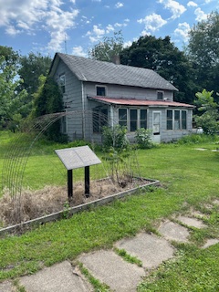
While in metropolitan Webster, we looked around at the big town. We found an old building that likely survived the Mormon era of the 1840’s. We relished in the fact that our ancestors likely shopped there (if it was a store at the time).

We looked across the street and found another unplanned plaque. This was dedicated to the memory of Ute Perkins, the pioneer ancestor of Sister Hunt (and our posterity with us that day).
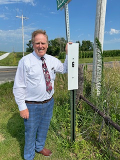
OUR TRIP TO RAMUS CONVERGED ON “THE MARTYRDOM TRAIL”
As we returned to Nauvoo from Webster, we took a rather rural route. Some members of the family had doubts that we would ever get back to Nauvoo reality (that women thing again), but I knew the direction that we would need to pursue. I knew too, that we were in the vicinity of the Martyrdom Trail (that I wrote about in the blog article entitled “Millions Shall Know Brother Joseph”). We were about half-way back to Nauvoo when I found the first Martyrdom Trail sign. Michael was the only one interested in getting out for a photo of the sign. He took a photo of me with the sign.
We did, indeed, make it safely back to Nauvoo. Another great history trek was history! (And I hope that Jackie will not be bruised for eternity because of the trek. I tried to stop at the Pioneer Cemetery as we approached Nauvoo, but she wanted nothing to do with that. That is when she mentioned the trauma I had inflicted on her in her youth with similar stops.)
It is so fun to be out on the trail discovering the facts of life … the dash of the lives of real people – and especially those who lived in and around Nauvoo.
This concludes Part 1 of the blog. You are invited to now go to Part 2 of this blog. There were just too many photos for one article. Stay on the trail … Markers, Monuments, and the dash. (Do not forget the DASH!)
Still on the marked trail in and around Nauvoo … Elder Hunt
